Michigan Maps Home > Michigan Map Collection > Detroit Map
Road Map of Detroit
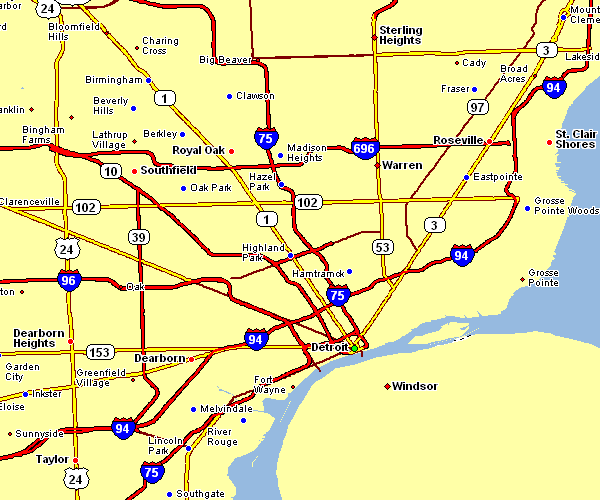
Above is a plain map that displays the political boundaries of this region with a simple selection of map components.
You are granted permission to print this web page and take advantage of it in your projects. Giving credit to this webpage would be awesome.
If you desire help locating a map, a special kind of map, or desire a proper specially made map, just email YellowMaps.
Acquire good tailor-made maps from us. Our custom maps cover a sizable selection of features, like: expressways, map projection, coordinate grid, caves, marine navigation features, sea features, geographical areas, or rivers, etc. Map types run from cultural to cartogram, digital to hardcopy, global to voting districts.
Proper maps are specific, complete, and not old. First-Rate map design by YellowMaps.
To purchase paper maps, like road atlases, maps of continents, or topo maps, just marvel at the cartographic delights in our map shop You can find more than 100,000 map items.
Ever wondered why there are so many different maps around? Well, to cover the whole of North America at let's say 1:24,000 scale, you will need more than 100,000 maps. This would be millions of maps if you want to cover the whole earth at that scale. It's a big place!
Back to Michigan map collection