Michigan Maps Home > Michigan Map Collection > Lansing Map
Road Map of Lansing
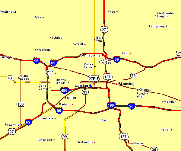
The image above is a simple map exposing the geography of this locale with a simple array of elements.
You are allowed to use this image and use it for many purposes. Providing a link to here is very much appreciated.
In the event you are hoping for aid getting a map, a specific map, or are hoping for a superior made-to-your-specs preparation, please contact our map specialists.
Acquire great customized maps from us. Cuztomized maps by YellowMaps have a useful diversity of details, for example: routes, legend, GPS coordinates, bays, major agglomeration areas, springs, falls, or road features, etc. Types of maps vary from road to orthophoto, navigation to general reference, block groups to planning regions.
Superior maps are clear, clear-cut, and not unclear. Finest cartography by YellowMaps.
To acquire hardcopy maps, such as road atlases, maps for kids, or maps for kayaking, just visit our map shop We carry more than 100,000 maps.
We love maps. A grand passion and delight. Show me a good map of the world..., they say.
Back to Michigan map collection